
Forestry works for peatland restoration at Bunloit Estate
By Keir Smith, Head of Forestry and Woodlands
As part of our aim to improve biodiversity and carbon storage on Bunloit Estate we are planning a project which involves forestry works and peatland restoration.
Bill’s Plantation, also known as Woodend, is an area of approximately 33.3 hectares that was planted in 1989. Most of the area was planted as a combination of Sitka spruce, Larch, Scots Pine and Lodgepole pine. This is a common productive conifer mix for planting schemes.

The ground preparation technique prior to planting was ploughing. The plough lines create ridges and these are the location where the trees are planted. The aim of this is to keep the tree roots drier to help the trees thrive.
The operations that are planned for Bills Plantation are to restore an area of peatland and to thin the remainder of the woodland. To restore the peatland an area around 6.8ha will be clear-felled and not replanted. This area is a mixture of Lodgepole pine and Sitka spruce. At the time of planting in 1989, the thought process on the bigger peat areas would have been to use the Lodgepole pine as a nurse crop.
Figure 1 Photo showing the ridges the trees are planted on
The Lodgepole pine have a nitrogen-fixing effect which benefits the Sitka spruce. When they are young the Sitka spruce make use of the nitrogen fixed by the Lodgepole pine which enables them to grow faster than the pine. Ultimately the Sitka should shade out the Lodgepole leaving a mature woodland of Sitka ready for harvesting. However, within Bill’s plantation this approach has not been successful.
The reason for the failure was the excessive depth of peat, which is over 3.5m in places, poor nutrient availability for the trees and a high-water table resulting in the tree roots not properly establishing. The peatland restoration will include blocking drains and ‘zippering’ together the ridges to create a more uniform, flatter surface as advised by Peatland Action.
As shown on the map below, this work will be one of three parts of a larger overall forest-to-bog restoration project.

Figure 2 Map of the proposed works
The other element of the works is to thin a wider area, around 25ha. This involves felling a proportion of the trees to create space for the remaining trees to grow better. By thinning these trees now the hope is that we can gradually progress the plantation to a system of closed-canopy forestry by carrying out enrichment planting. This will have biodiversity benefits as will avoid the need to clear-fell large areas in the future. The thinning works are covered by the Long Term Forest Plan (15FGS01853) which was approved in 2018 for the previous owners of Bunloit Estate and runs until 2028.
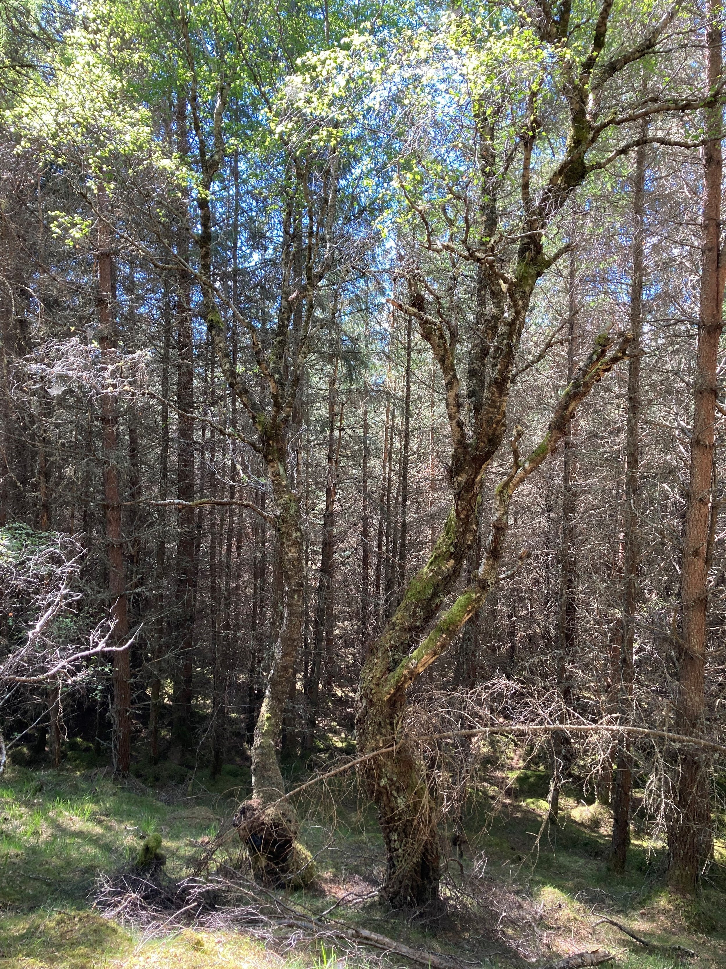
This photo shows a birch tree within Bill’s Plantation. The conifers around the tree will be removed as part of the thinning works. This will open up the space for the birch tree to grow better.
To carry out the forestry works, a temporary entrance will be built from the plantation onto the Bunloit Road. The location of this has been selected to be close to the trees being removed and provide good lines of sight for vehicles pulling out of the entrance. This is temporary access with a view to it being reinstated after the works are completed.
Figure 3 Photo of a birch tree within Bill's plantation
We estimate that a total of around 3,000 tonnes of timber will be felled during the work. The timber lorries taking the felled trees to the sawmill will be part of the timber transport plan for the area, which is managed by the Highland Council. This plan has a limit of 6 timber wagons per day across all the landowners in the area. We will have an allocation for our timber removal and will operate within constraints around time of day, such as avoiding school run times, to minimise impact as much as possible. We’ll put the forestry work out to tender with a focus on local contractors.
Subject to planning being approved, our aim is to start the works this autumn. This will be after the breeding bird season. Prior to operations commencing, wildlife surveys will be carried out to identify squirrel dreys, mammal hibernation areas and bird winter roosts to avoid disturbance. If any are identified, buffer zones will be implemented in line with the UK Forestry Standard.
We had a meeting on site on 19th July to discuss the plan with members of GURCA (The Glen Urquhart Rural Community Association) and Glen Urquhart Community Council.
The plans are on the Highland Council planning website for comment until Thursday 1st August. The information includes a location plan and a map of the proposed temporary entrance: https://wam.highland.gov.uk/wam/applicationDetails.do?activeTab=documents&keyVal=SEANUUIHM5500
Please submit any comments on the forest entrance via the planning portal. We will provide further updates as the project develops.